![]()
![]()
September 15 , 2019
Sunday morning Tom found out that he could not move. Apparently driving the rough off road he suffered sever whiplash the previous day After some manipulations and 'special' relaxer pills he was able to move once again. Today we were joined with Dave, Chuck and Kevin. Our destination for the day was to find the Jumbo Mine which had a deep history attached to the town of Jungo on Jungo Road and the shore of Jungo Dry Lake.
The fastest way to the Jumbo Mine was an almost straight line from Jungo Road where the town of Jungo once existed and across Jungo Dry Lake. The route was used quite a lot in the early days to get ore from the mine to the railroad at Jungo BUT that route is much faded with time and trying to find it in previous years we always ran into nothingness. A better route using actual known roads was to travel to the town of Winnemucca and head north on Rt95, a paved highway. About 37miles north of Winnemucca we turned West on Rt140. Then about 2 miles later we turned left off onto a gravel road which curved west then turned straight on Sand Pass Rd for about 12 miles.
At a 'major' crossroad (41° 20' 26.5" N 117° 55' 13.1" W) Sand Pass Road turns left but we continued straight and the road turned to dirt, but it was still a road. Traveling on a semi rough dirt and gravel road we began an uphill ascent curving back and forth into the Slumbering Hills area of northern Nevada. At times it gets a little rough but it is always passable (don't take the family car).
We reached the top of the hill and found a large wooden headframe. (41° 17' 59.4" N 117° 59' 53.2" W) Needles to say we were a bit disappointed there was no other structures even though our GPS told us we had arrived at the Jumbo Mine District.
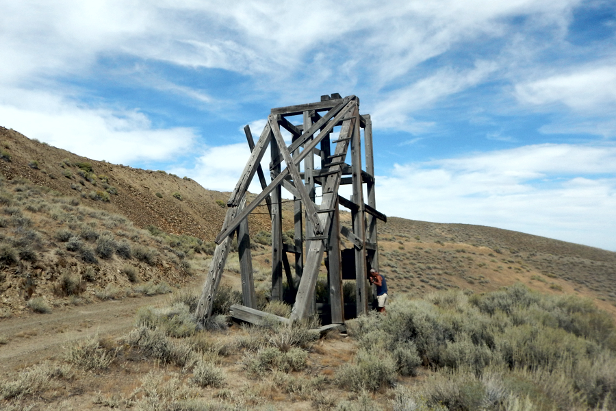
The headframe at the top of the hill used for raising & lowering buckets from the mine below.
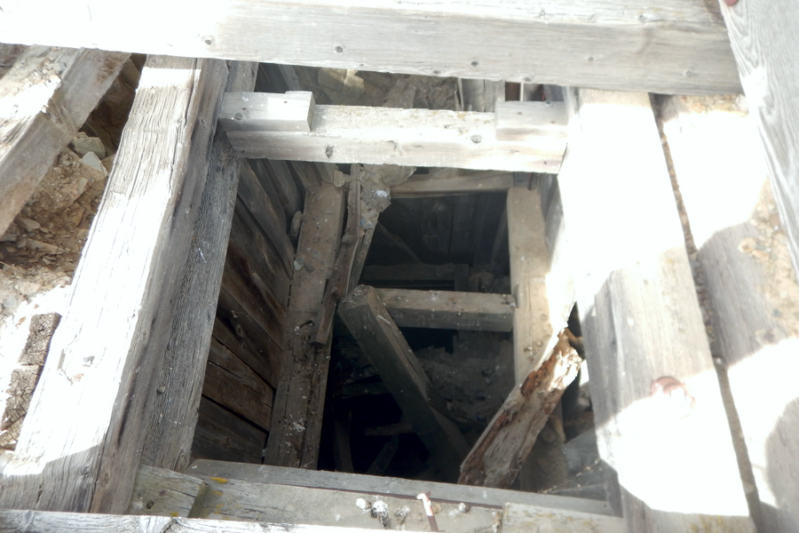
Looking down the shaft under the headframe. Tempting but none of us climbed down.
We turned around thinking we were actually lost (we get lost a lot) and just by chance opted, instead of heading back down hill, to turn left at the 'Y".(41° 18' 05.2" N 117° 59 '44.7" W) Low and behold there it was, Jumbo Mine laid before us. (41° 18' 10.4" N 117° 59' 59.6" W).
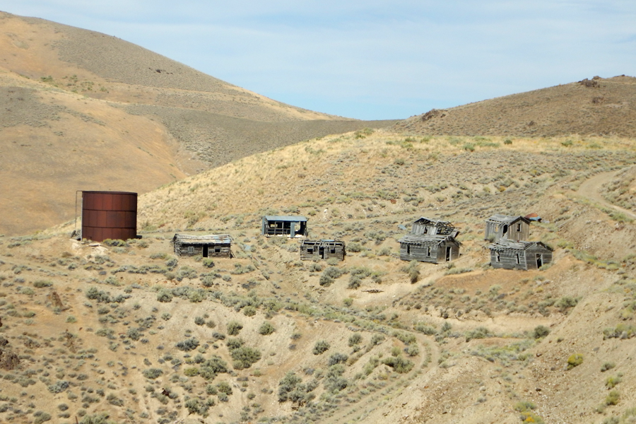
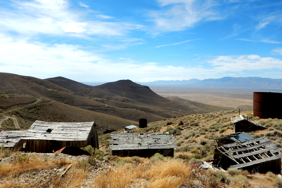
Jumbo Mine is a large complex of still standing structures spread out all over the hillside. Wooden buildings, large metal storage tanks and all sorts of interesting things still remain.
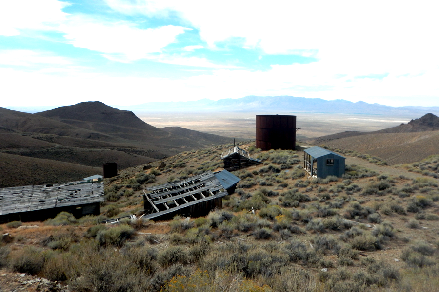
First view of the Jumbo Mining District looking out over the northern part of Jungo Dry Lake
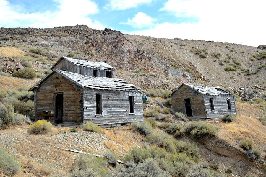
Several of the wooden houses still stand in the residential area.
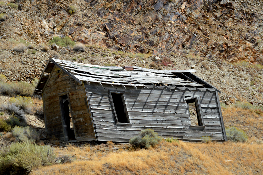
While most structures are safe to enter this one raises questions.
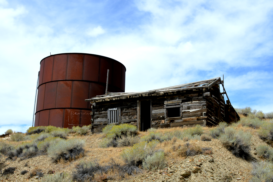
The most solid building is this railroad tie structure right below the upper metal storage tank .
An overview of the upper tank and Jumbo's residential area.
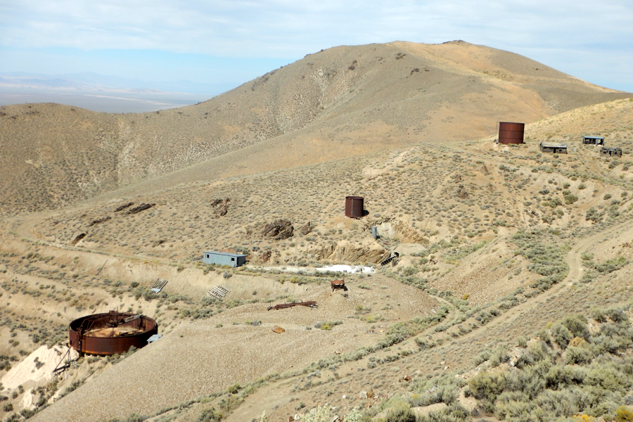
An overview of the three metal storage tanks , the machine shop and mine entrance.
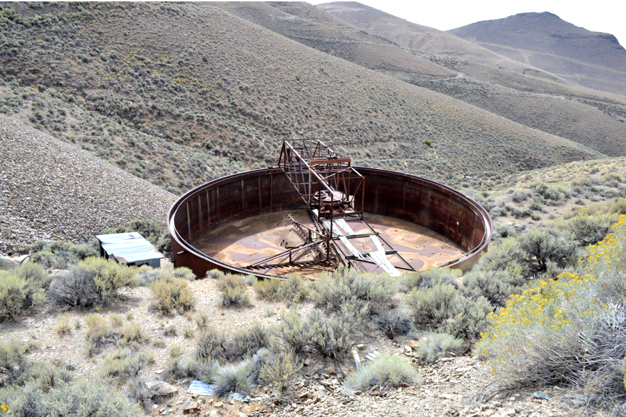
Looking down into the lowest tank shows a slurry system set up.
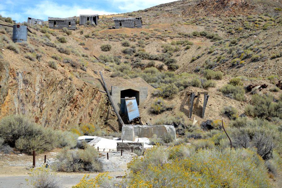
What is left of the Jumbo Mine entrance.
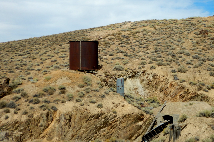
The middle tank with piping and pressure tank right above the mine entrance.
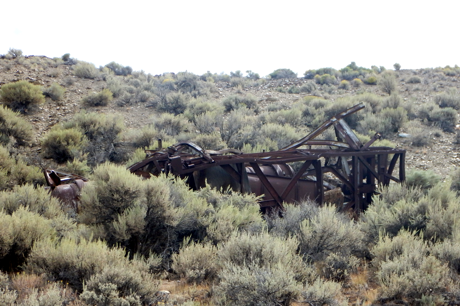
Some sort of metal tower that collapsed.
From the top looking downhill you can see all the roads going everywhere.
We didn't have time to travel them all even though we might find a route down to Jungo Dry Lake.
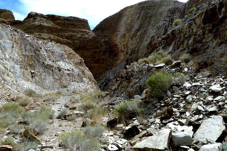
At the top of the hill is a man-made canyon heading into an open pit area.
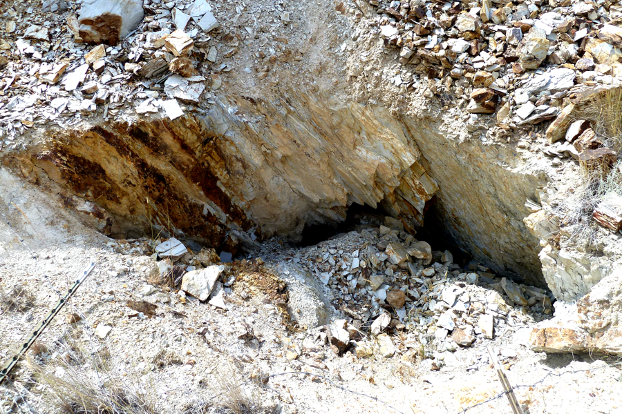
There are several mine entrances either caved in or filled with debris.
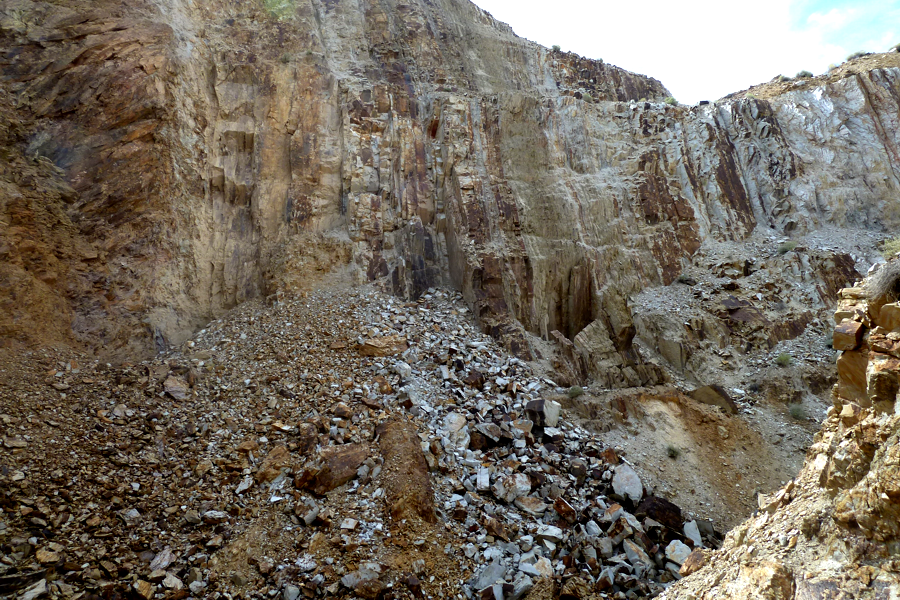
Inside the open pit canyon. Lots of rocks but nothing exciting.
After spending some good time exploring the area we opted to head back the way we can and head for Fernley, the La Fiesta restaurant and our annual Dinner.
