![]()
![]()
►►ZOOM IN FOR DETAILS◄◄
►►CLICK HERE TO VIEW LEADVILLE IN GOOGLE MAPS◄◄
41º 05’ 56.13” N 119º 24’ 10.75” W
Leadville, Nevada is considered a Ghost Town. To get there head out of Gerlach onto State Route 34 and turn left on a dirt road around 38 miles outside of town. Once you turn left on the dirt road travel about a mile and you're there. You need an SUV or pick up, the road is rough but not that rough.
Development work began after lead-silver discoveries in 1909, although actually abandoned in 1926 the district produced modestly off and on until as late as 1940/41. Lead and silver ore was mined from the Tohoqua Mine, from quartz veins. Minor deposits of zinc and gold were also found, as well as niter (saltpeter) in crevices of rhyolite uncovered on the western side of the range.
Click On Images For Larger Versions |
||
 |
 |
|
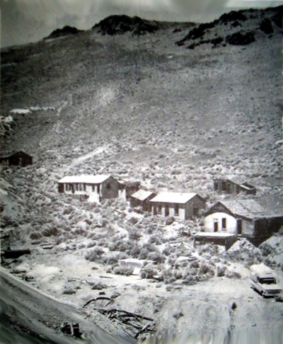
On the left a B&W of what was there even years after it was abandoned. On the right a color photo of what's there today. - Maybe. |
||
X |
X |
|
 |
 |
|
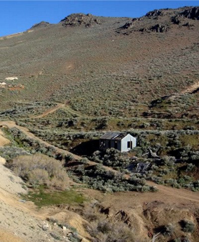
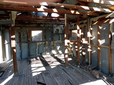
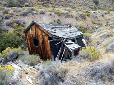
One of three remaining structures can be seen almost as soon as you leave the main road. After all these years it still stands. |
||
X |
X |
|
 |
 |
|
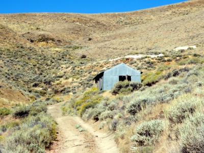
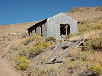
The interior leaves a lot to be desired but it did have girly magazines! |
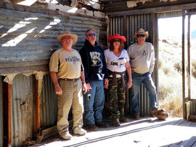
Hardy explorers Dave, Larry, Deb and Tom. |
|
|
||
The property consisted of three main claims developed by two shafts, a 1700 foot tunnel, and a 500 foot winze (a steeply inclined passageway in a mine) equipped with two 75 and one 100-horse power and semi-diesel engine, compressor, electric locomotive, auto trucks, 7500-foot water line, and 30,000 gallon tank. Also in operation was a 35-ton mill and flotation plant. All this was incorporated in 1920 with capital stock of $1,500,000.
 |
 |
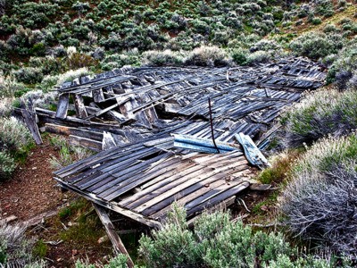
One of the large buildings seen in the B&W photo lies flattened. |
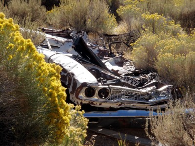
Another suffers the toll of time and weather - along with a car. |
X |
X |
 |
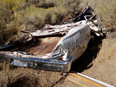 |
Yes it's a Ford Fairlane. We wondered how it got flattened then realized it had to have rolled down the hill from the road above. |
|
X |
X |
 |
 |
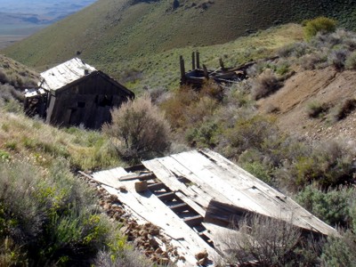
Another flattened building and two structures still standing - kinda. |
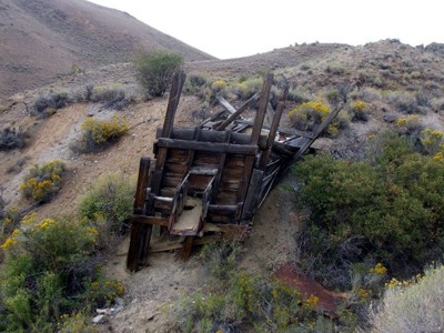
A work shed of some kind sits in a gully. |
X |
X |
 |
 |
A loading chute also sort of stands near the shed. |
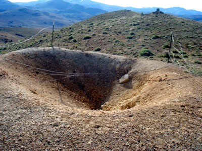
A closed up mine shaft sits at the top of a hill. The fence is there for a reason. |
Like all mining activities, ore petered out, and production ceased. Still remaining is the Blacksmith shop, two collapsed buildings, some trestle work and extensive tailings. The actual mine is boarded up and said to be leaching arsenic. . No one is living in Leadville at the present time, but some sort of lease or claim on the mine was filed in Feb, 2011.
 |
 |
The main mine is heavily boarded up and with good reason judging by the water that constantly drains out. It's a lead mine and the water has arsenic in it. |
|
X |
|
 |
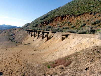 |
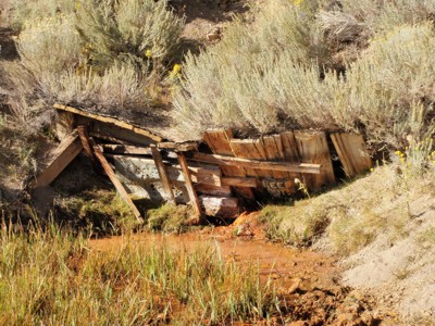
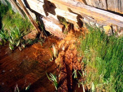
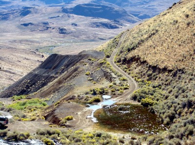
The pool lower left is the mine run off of water. A trestle can be seen right above. |
Better photo of the trestle which ran ore cars and dirt. |
X |
X |
 - - |
 |
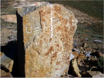
A stone marker sits at the top of one of the hills signifying something. |
|
X |
|
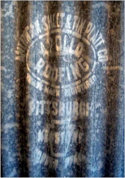
With some of us coming from the Pittsburgh, Pennsylvania area we found the galvanized siding (from Apollo, PA) shown on the right to be of interest. There is still plenty to find at Leadville if you take your time to wander around and look. |
|
|
|