![]()
![]()
►►ZOOM IN FOR DETAILS◄◄
►►CLICK HERE TO VIEW PYRAMID CITY IN GOOGLE MAPS◄◄
39° 51' 51" N 119° 37' 07" W
Pyramid City is not hard to find being only 18 miles west of Nixon, Nevada, From Rt 447 head west to Sutcliffe on Rt 446. At Rt 445 head south toward Sparks on Pyramid Highway. Pay attention and at about 3½ miles you'll see a road on the left that heads to where Pyramid City used to be.
Called Pyramid City it was a silver mining camp existing from about 1877 to 1889. Two miles above the camp was the site of Upper Pyramid, sometimes referred to as Jonesville. In its time it had two saloons, a Chinese wash house, store, boarding house, and a stage line with daily service to Reno." Pyramid City was reportedly in Roop County until 1883, when Roop County became part of Washoe County. However, a map of the State dated 1866 shows Washoe County's northern border coming right up to Pyramid Lake, which would almost certainly have included the site of Pyramid City.
The district was first organized in 1866 and encompasses about 20 sections. Maximum productivity occurred prior to 1890. From 1890 to the present there has been only limited, small-scale mining activities. Incomplete records indicate the extraction of about 3,000 tons of gold and silver ore grossing approximately $95,000.. Uranium was discovered in the Pyramid area in 1954.
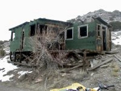
All that remains of the lower site is a wood frame building of obvious later vintage, a trailer, several neglected cars, and scattered debris. One can look at the site and visualize how it might have been laid out, however. There is also a grave, marked "Frank # ," where the '#' represents an unrecognizable character. Looks like old Frank might have cashed it in in 1939 or thereabouts, but hard to say.
Click On An Image For A Larger Version |
|
 |
 |
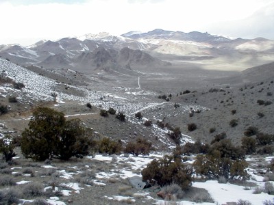
Looking down the road to the main highway |
A relatively new building at the lower level |
 |
 |
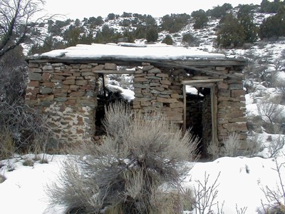
An old rock structure still exists |
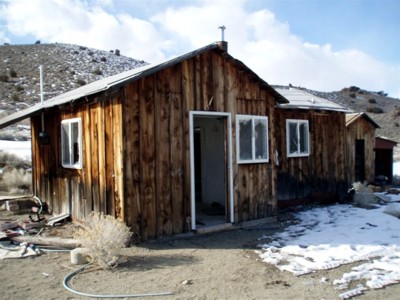
Several wooden buildings have survived |